 Following are excerpts of an article in the Envirtonment section of today’s Washington Post. It was written by Brian McNoldy.
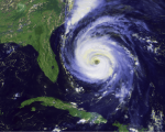
“It was a hurricane season almost without hurricanes. There were just two, Humberto and Ingrid, and both were relatively wimpy, Category 1 storms. That made the 2013 Atlantic hurricane season, which ended Saturday, the least active in more than 30 years — for reasons that remain puzzling.
The season, from June through November, has an average of 12 tropical storms, of which six to seven grow to hurricane strength with sustained winds of 74 mph or greater. Typically, two storms become “major” hurricanes, Category 3 or stronger, with sustained winds of at least 111 mph.
In 2013, there were 13 tropical storms, a typical number, but for the first time since 1994 there were no major tempests in the Atlantic. The last time there were only two hurricanes was 1982.
The quiet year is an outlier, however, in the recent history of Atlantic cyclones. The National Oceanic and Atmospheric Administration notes that 2013 was only the third calmer-than-average year since 1995.
The most intense storms this year had maximum sustained winds of only about 86 mph. [$\ldots$], the weakest maximum intensity for a hurricane during a season since 1968. The first hurricane, Humberto, was just hours from matching the record for the latest first hurricane, Sept. 11.
In terms of accumulated cyclone energy (ACE), the seasonal total stands at 31.1, the lowest since 1983 and just 30 percent of average. (ACE is the sum of the squares of all of the storms’ peak wind speeds at six-hour intervals, and a good measure of a storm season’s overall power.) Looking back to 1950, only four other years had lower ACE totals: 1972, 1977, 1982 and 1983.
[$\ldots$]
Why was this season so inactive? What did the forecasts miss? Although there are some hypotheses, it is not entirely clear. We may have to wait another couple of months, but in the meantime, there are some potential explanations.
Major signals such as the El Niño Southern Oscillation (ENSO), surface pressure and sea-surface temperature all pointed to an average to above-average season. But there were some possible suppressing factors.
Dry air
Even over the long three-month window of August to October, the vast majority of the tropical Atlantic was dominated by drier-than-normal air, especially in the deep tropics off the coast of Africa. Dry air can quickly weaken or dissipate a tropical cyclone, or inhibit its formation.
Stable air
The average temperature profile in the region was less conducive to thunderstorm growth and development during the core months, which means that the amount of rising air in the region may have been reduced as well.
Weak African Jet Stream
Tropical waves, the embryos of many tropical cyclones, have their origins over continental Africa. A persistent feature called the African easterly jet stream—a fast-moving river of air in the low and middle levels of the atmosphere—extends from Ethiopia westward into the tropical Atlantic Ocean. It breaks down into discrete waves, and every few days another wave leaves the coast. Some are barely noticeable, while others become tropical storms.
During the height of the hurricane season, most tropical cyclones form from disturbances off the coast of Africa. Winds in the jet normally cruise along at 20 to 25 mph at an altitude of 10,000 feet from August to October, but this year they were about 12 to 17 mph weaker. One would expect that to have a big impact on the amplitude of easterly waves and the hurricane season.
Links to Global Warming?
One question that inevitably is asked is how the season’s inactivity relates to climate change. It’s not accurate to associate any particular season (and definitely not a specific storm) with climate change. One season’s activity does not allow any conclusions about the role of climate change. The reason is that intra- and inter-seasonal variability is so large that any subtle signals of influence from climate change are overwhelmed.”
Brian McNoldy is a tropical weather researcher at the University of Miami’s Rosenstiel School of Marine and Atmospheric Science and a contributor to the Capital Weather Gang blog on washingtonpost.com.